TRAIL RUNNING THE VIA ALPINA - SWITZERLAND
STATS:
TIME: 6 DAYS 18 HRS 40 MINUTES
DISTANCE: 383KM
VERT: 21602m
CALORIES BURNED: 42500
GRAMS OF SUGAR CONSUMED: 1.5KG PER PERSON
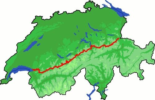
In the summer of 2019 Milo Zanecchia, Alex Borsuk and Matt Hasenhor ran across Switzerland taking the famous Via Alpina route from the border of Liechtenstein to Montreux, on the border with France. To do it as fast as possible, we took the bare minimum and tried to pack it all into one comfortable trail running vest each. This meant having basically two outfits, one for running during the day and one to change into at night while we let our sweaty clothes dry.
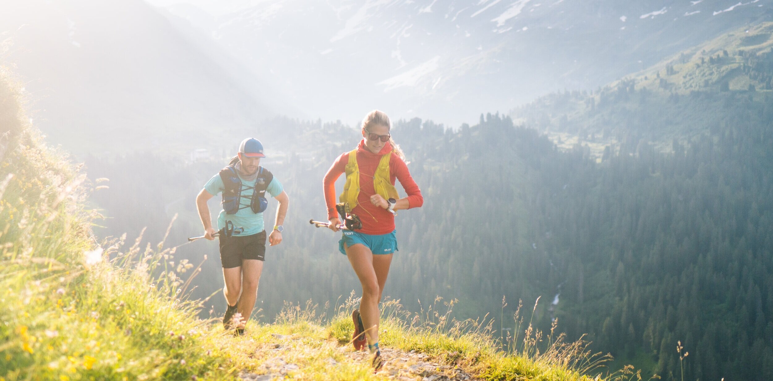
Our goal was to do this as fast as possible, which meant averaging about 50km per day with 3500m of climbing, and having no support from aid stations or friends meant carrying a lot of food since we would finish most days long after restaurants or huts closed.
I write this blog post as a resource for others interested in doing a similar route, as a record for us to remember the highs and lows, and to help us plan better for future adventures. When an adventure is over I find it a bit sad to simply bury the images on a hard drive or in a Dropbox folder while only posting a few images on social media. This platform gives me an opportunity to keep all the memories in one place.
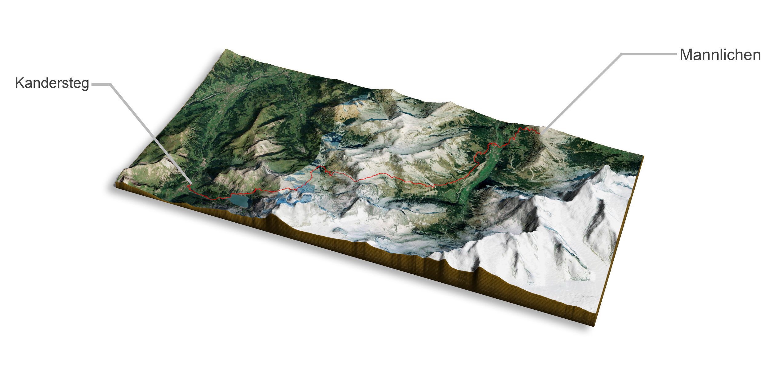
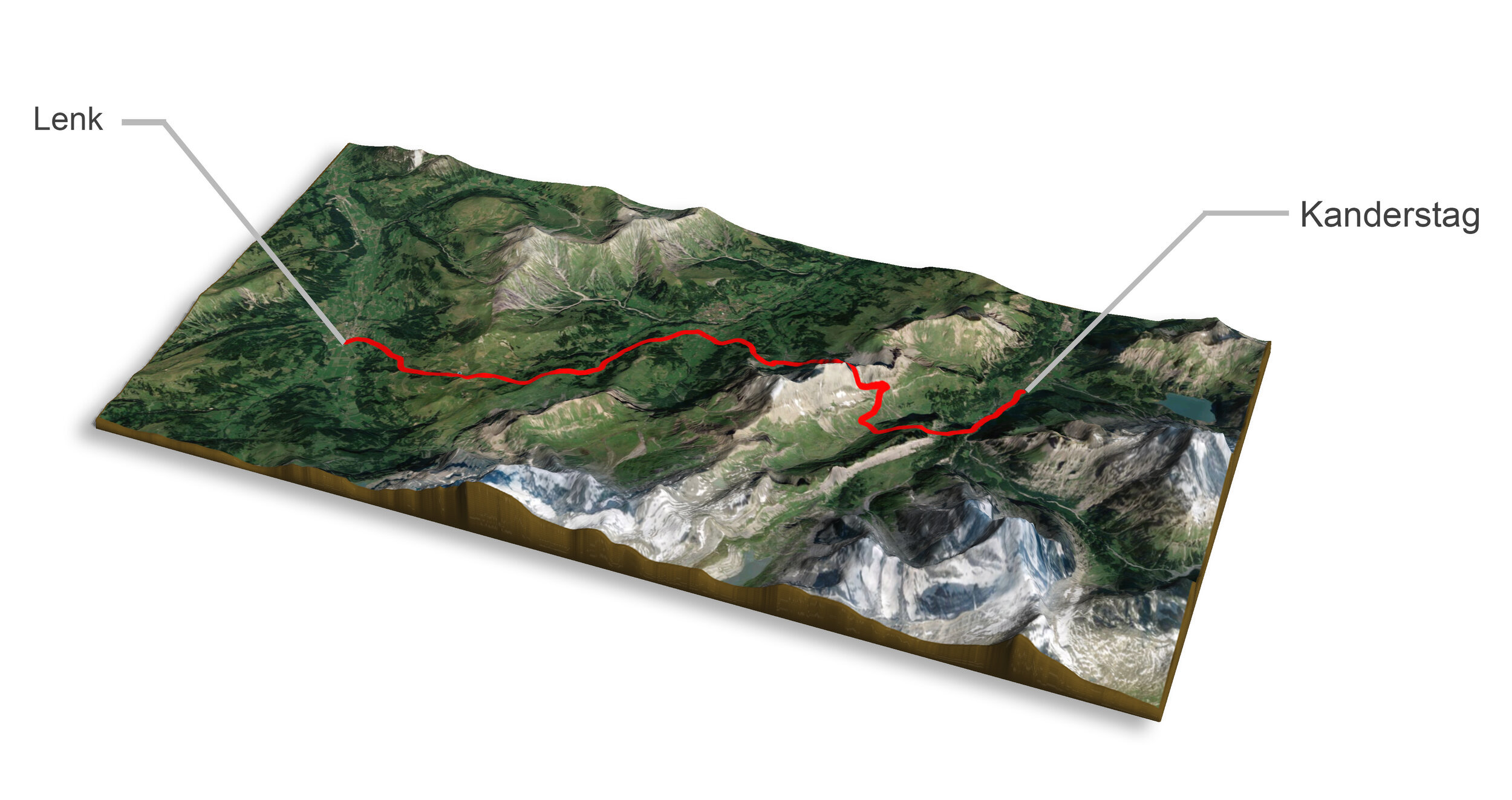
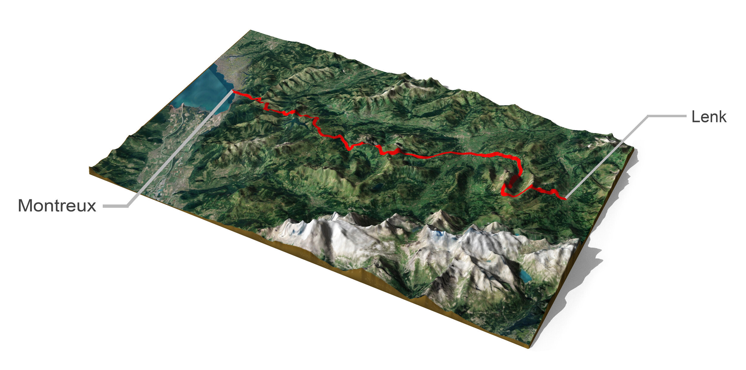
Here is a 3D map of our route, made of our combined GPX files from the run.
All images were taken on an iPhone X and Sony a6300 with a fixed 35mm 1.8 prime lens. I chose this camera setup because I needed commercial quality out of these images, but also couldn’t carry unnecessary weight. When your pack weight comes down to each gram, sadly the camera also has to compromise a little. I thought about carrying an A73 with a 24-70 f2.8 or f4 but it was going to be too heavy and would take up all my space. I also needed something that could be easily accessible or else I’d never pull the camera out. The a6300 with a prime lens fits perfectly in the front pocket of a trail running vest. For the official images taken for Salomon, see our Work page or scroll to the bottom of this for a link. Enjoy.

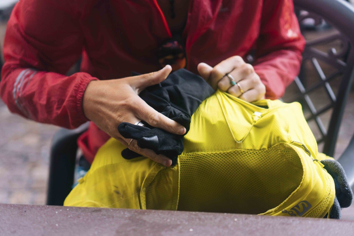
List of items we were carrying each day. On top of this we’d usually stop at a supermarket and add an extra 1-2kg worth of food and water. Alex’s yellow 12L pack already smelled like dirty cheese before we even left.
DAY 1
Distance: 70km
Vertical Climb: 3812m
Start / Finish Time: 04:45 - 23:00
Sargans > Foopass > Elm > Richetlipass > Linthal
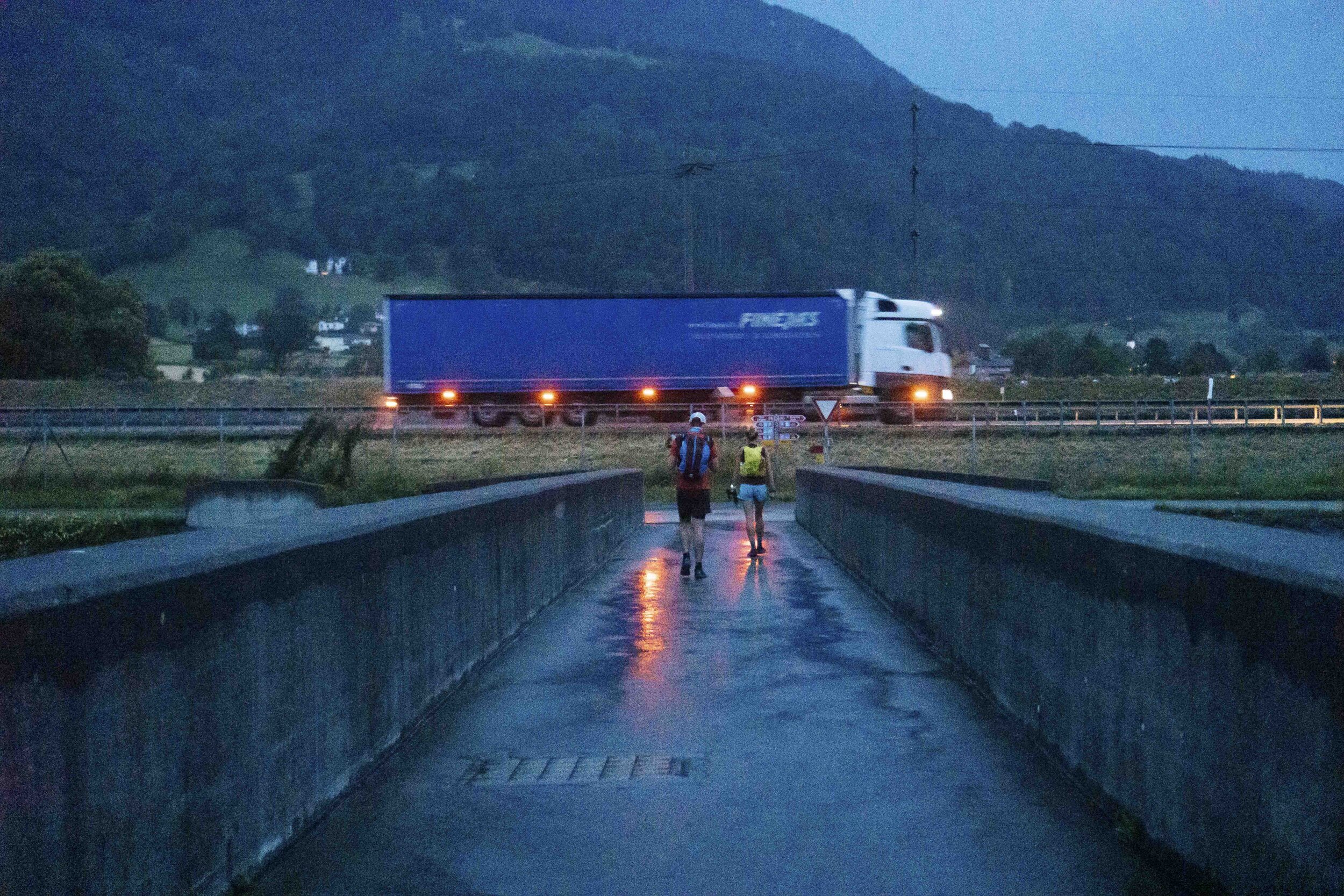
To start this right we took a 4am bus out of Sargans to cross a bridge and technically start in Liechtenstein. This was a last-minute decision which added a solid 10k to the route and set us up for a rough first day ahead. First section of the day was a long, flat run through Sargans and then a gradual climb up to Foopass.


Alex showed me a whole new level of what nervous poops can be. For those of you who haven’t run a race, the excitement combined with a bit of stress and anxiety causes you to empty out anything that might be extra weight throughout the day.

Shortly after starting our climb, the first of a few storms hit us fast. We took cover under a rock to wait for the lightning to pass, eating paprika chips and wondering how long we might be stuck there. After waiting there for an hour we realized on our map there was a hut right at our location, but we couldn’t see it. Turns out all that time the hut was right above the rock we were hiding under. We were treated to a nice morning beer and snacks as we watched the skies clear.


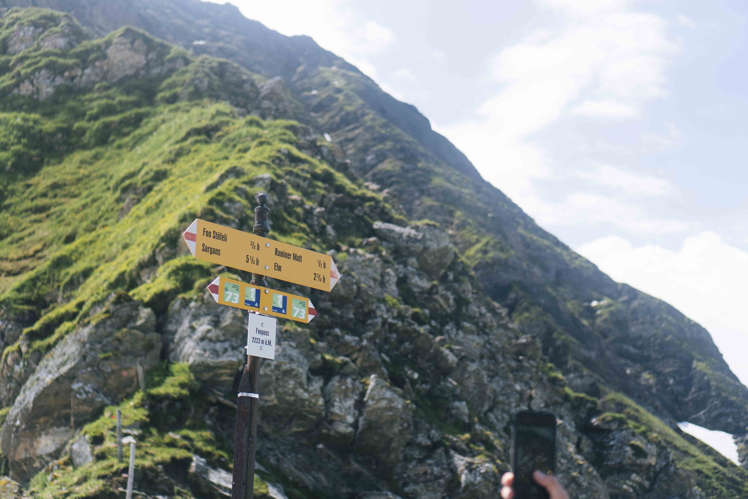


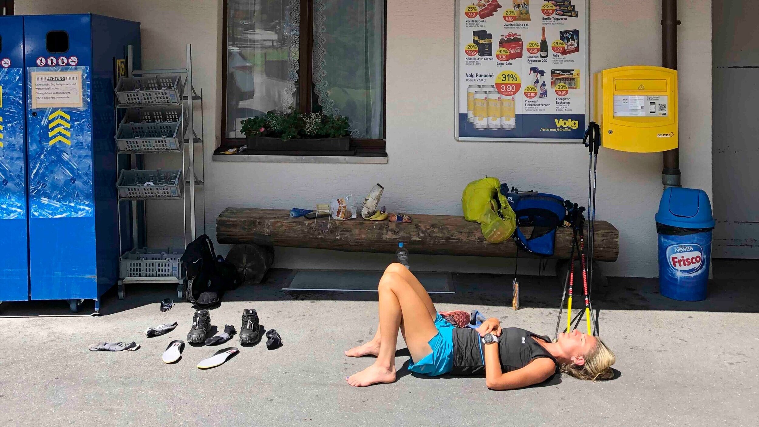
We reached the top of Foopass and descended into Elm to stock up on water and food after 45km that morning. Lying down on warm pavement is a five-star experience when everything on you is wet and you’re dead tired.
After drying off all our gear, eating, and hydrating as much as possible, we set off for our second pass of the day on our way to Linthal. We stocked up on instant rösti packets assuming we would arrive at our destination late after everything had closed.


False peaks are what appear to be the tops of mountains but actually aren’t. We thought we had reached the top of the second mountain pass, but in the images below we realized our pass was that snowy saddle in the distance. We sat there for a few minutes thinking it wasn’t possible, but there was only one way to Linthal and it was over those mountains.


…the first of many naps on warm pavement. We were close to the finish line, but it felt so good to just sit down sometimes. We would always regret it though, pulling ourselves back up to finish the run down.


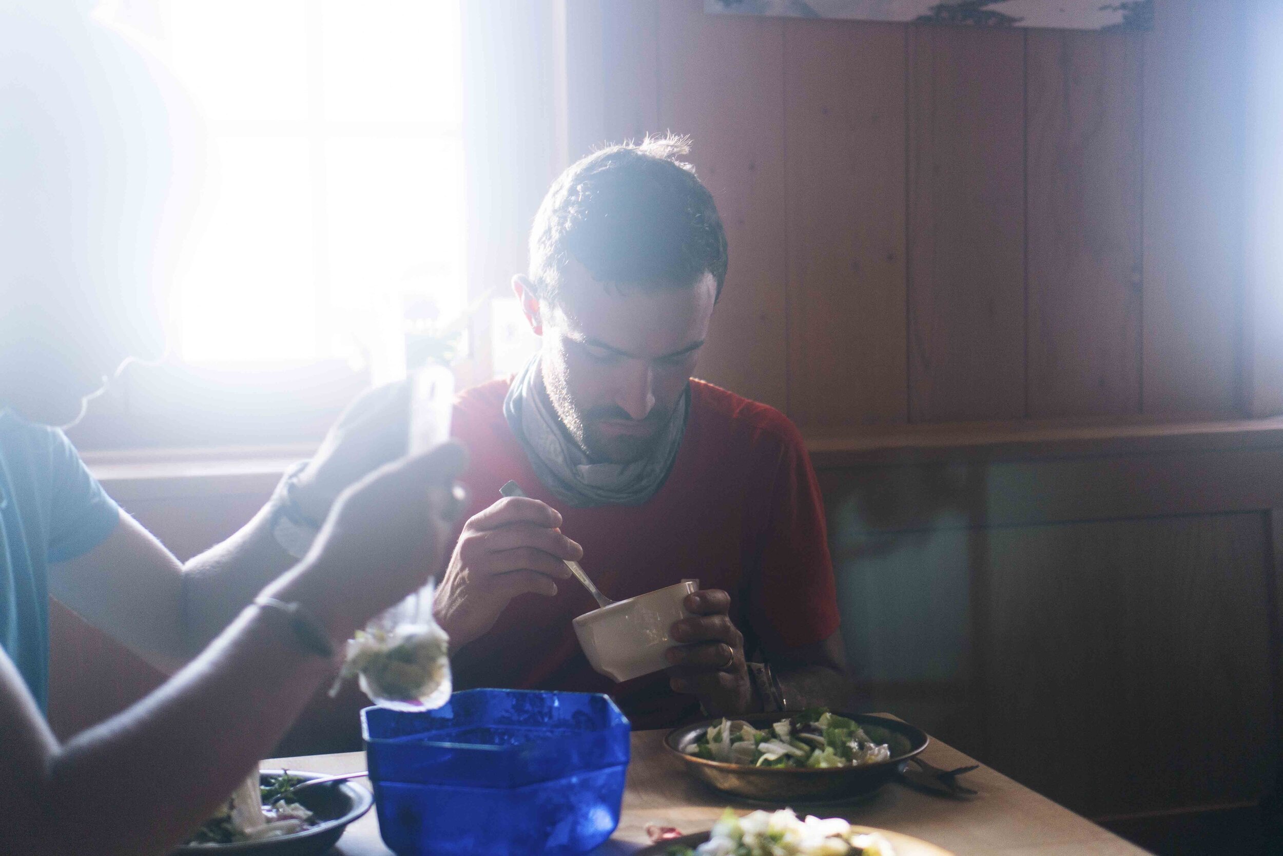
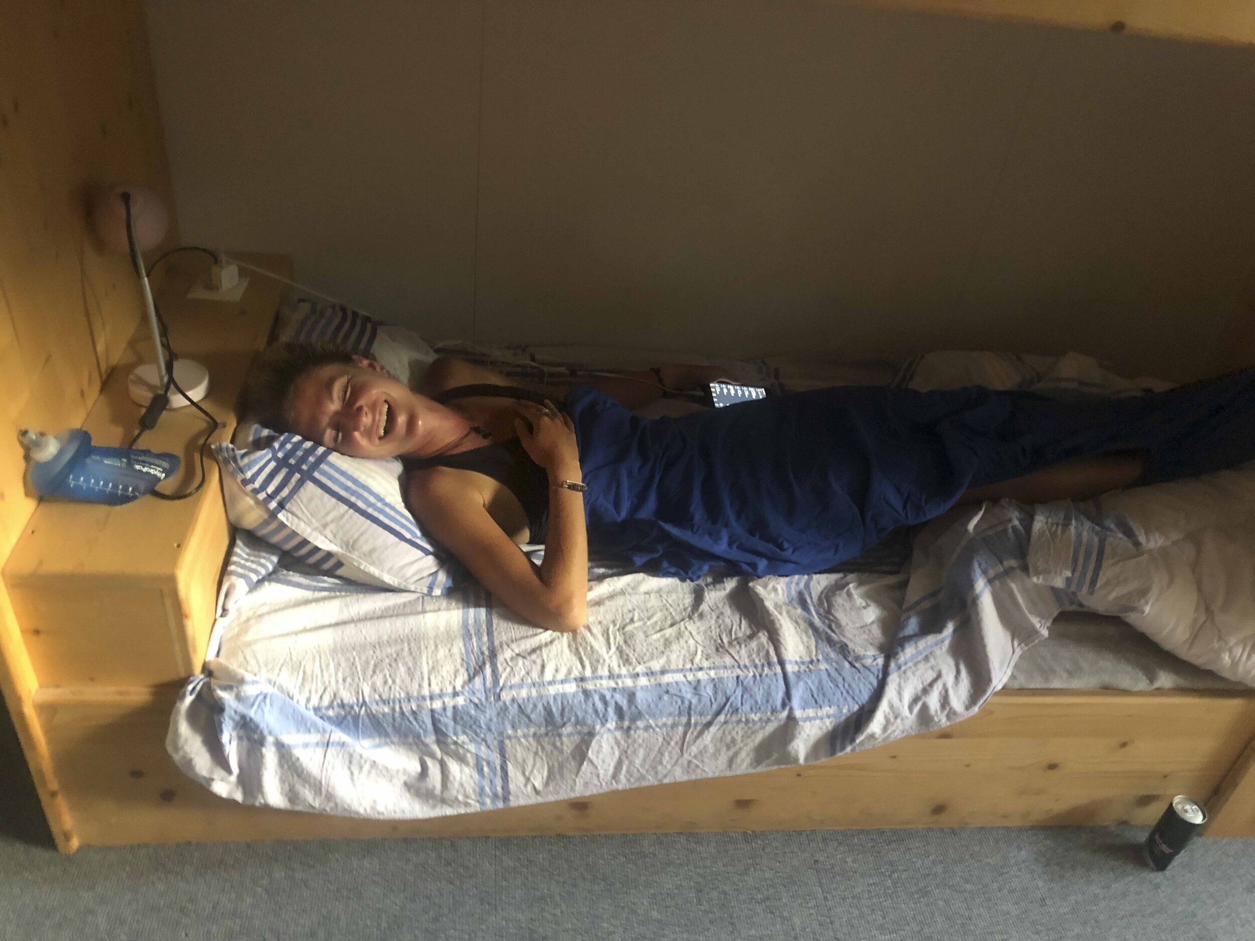
After eighteen hours on our feet we arrived in Linthal at around 23:00, where we spent twenty minutes stumbling around trying to follow the AirBnB instructions just to find the key. Finally making it into the apartment, we discovered the so-called “kitchen” was a broken hot plate. We half-microwaved the rösti we picked up in Elm and sat there exhausted, eating one of the most disappointing meals one could imagine after a 70km day. We fell asleep hungry, knowing the next day we weren’t going to be feeling good. This was the first time we started to wonder why we were putting ourselves through this pain.
DAY 2
Distance: 40km
Vertical Climb: 1600m
Start - Finish Time: 09:30 - 18:30
Linthal > Altdorf
We woke up with what felt like one of the most brutal hangovers any of us had ever had. Dehydrated, hungry, sleep-deprived, sore… We went directly to a supermarket to try and fuel up before another tough day. After we finished breakfast it started downpouring before we even left Linthal, with most places closed because it was Sunday. We took shelter in a retirement home where we got confusing looks from the elders walking by at 10:00.


Pretty broken from the day before, we decided to keep this day relaxed and get to Altdorf to catch up on sleep and wash our smelly underwear and socks. We were pretty sleep-deprived and sore from the day before so we treated ourselves to some good food and a clean hotel room.


DAY 3
Distance: 40km
Vertical Climb: 2750m
Start - Finish Time: 06:30 - 17:00
Altdorf > Trubsee (above Engelberg)
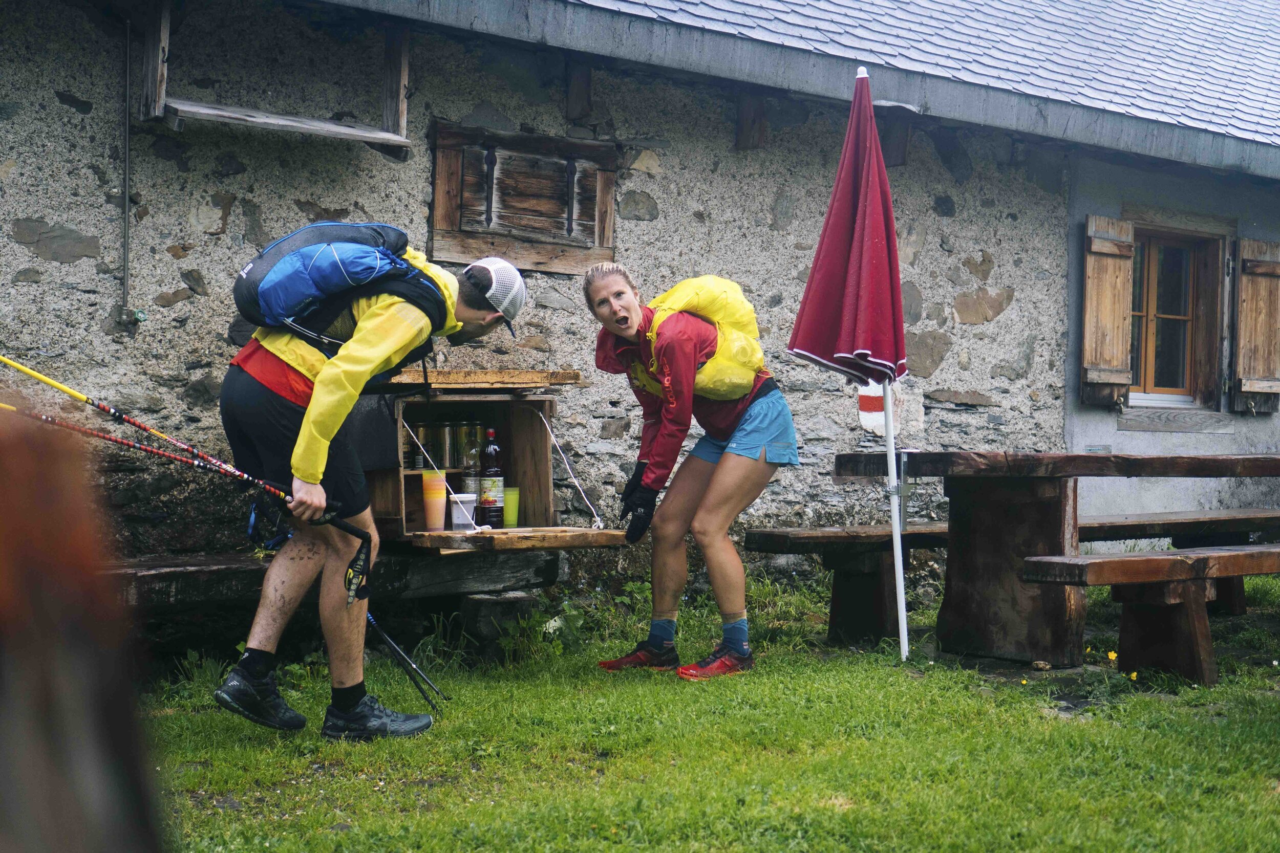
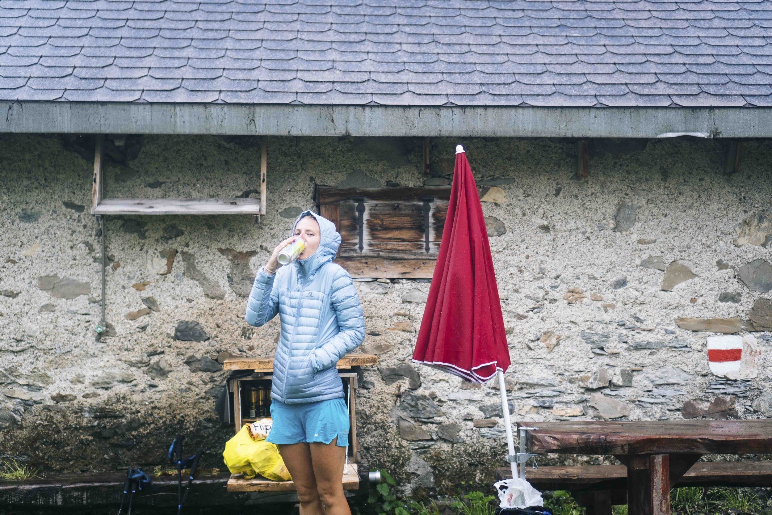
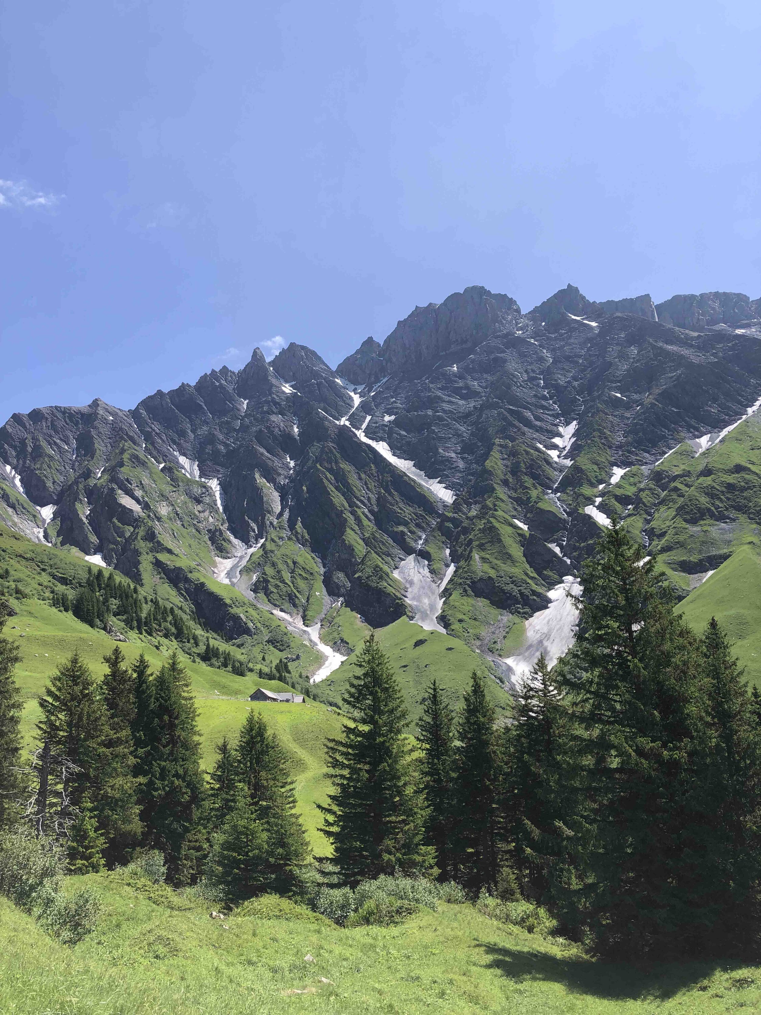
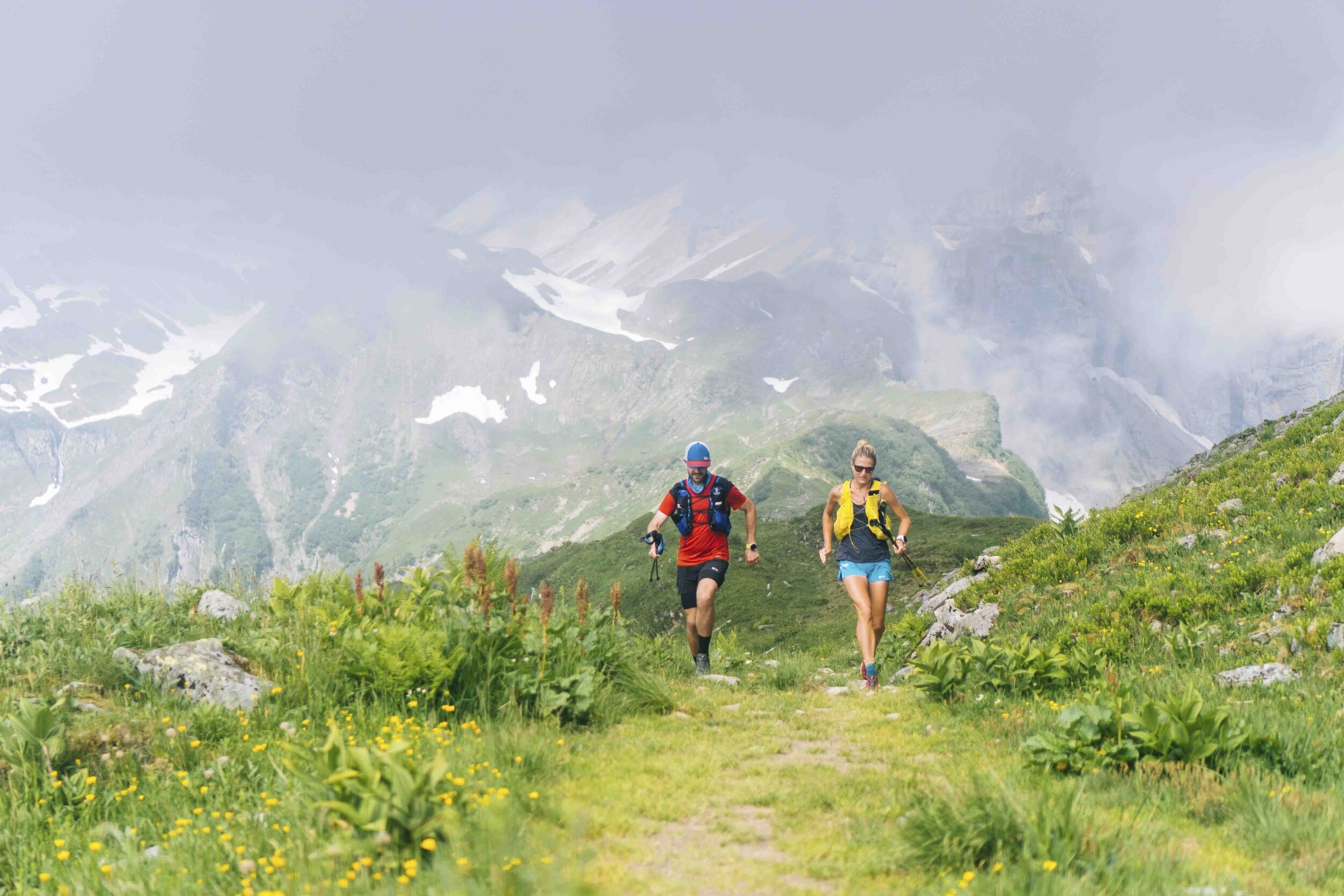
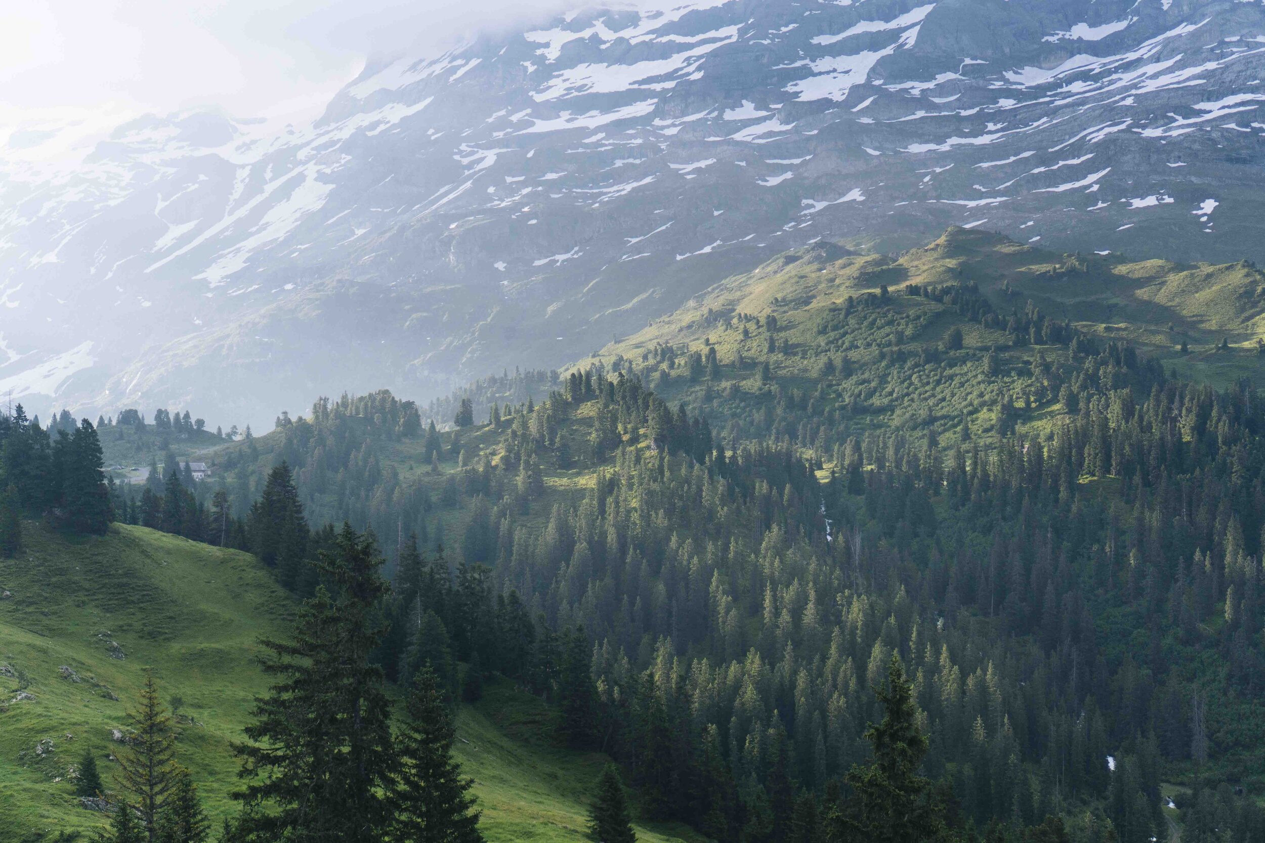
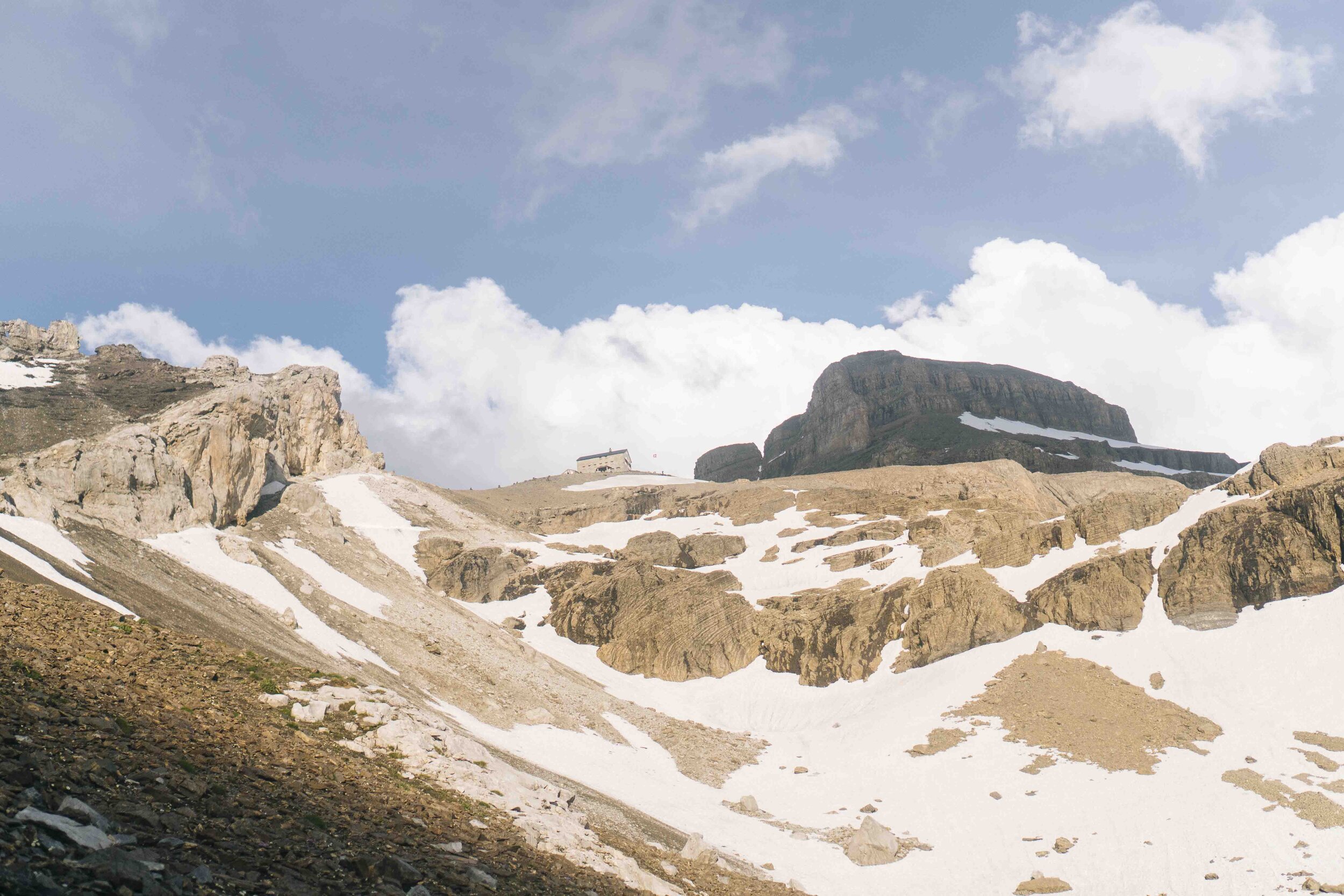
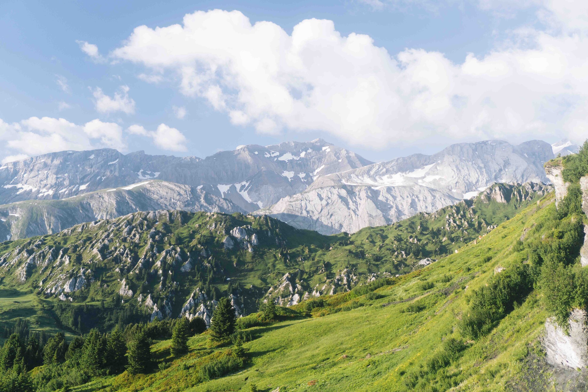
Today was the day we wanted to get some extra kilometers in to get back on schedule, but we got rained out after reaching Engelberg so had to stop at the Trubsee lake a few hundred meters above Engelberg. The trail out of Altdorf up the Surenenpass was one of the most beautiful trails we’d been on. It was a long, gradual climb that ended in a steep final section taking us up a snowy ridge to our first views of Mt. Titlis and the Engelberg Valley. Reaching Engelberg was a big confidence boost that this entire idea was attainable.

Half-washed, smelly socks drying on the back of our packs… It was always a bit of a race to push one of us to the back where that person would be in the smelly airstream of the two up front.
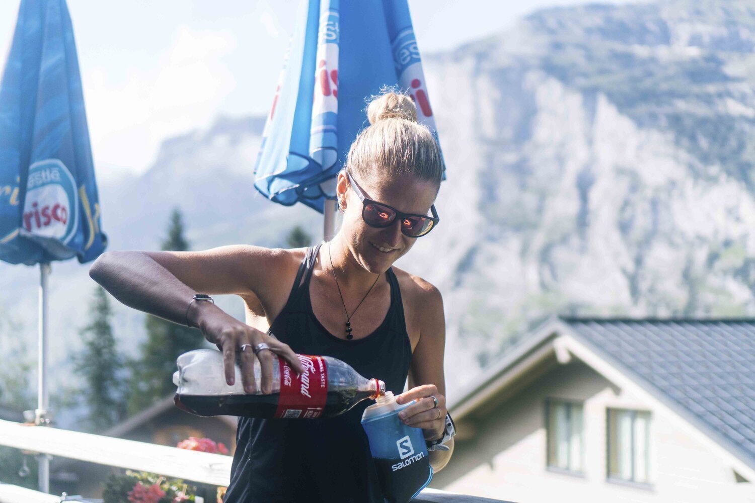
More sugar!


First view of Mt. Titlis above Engelberg.

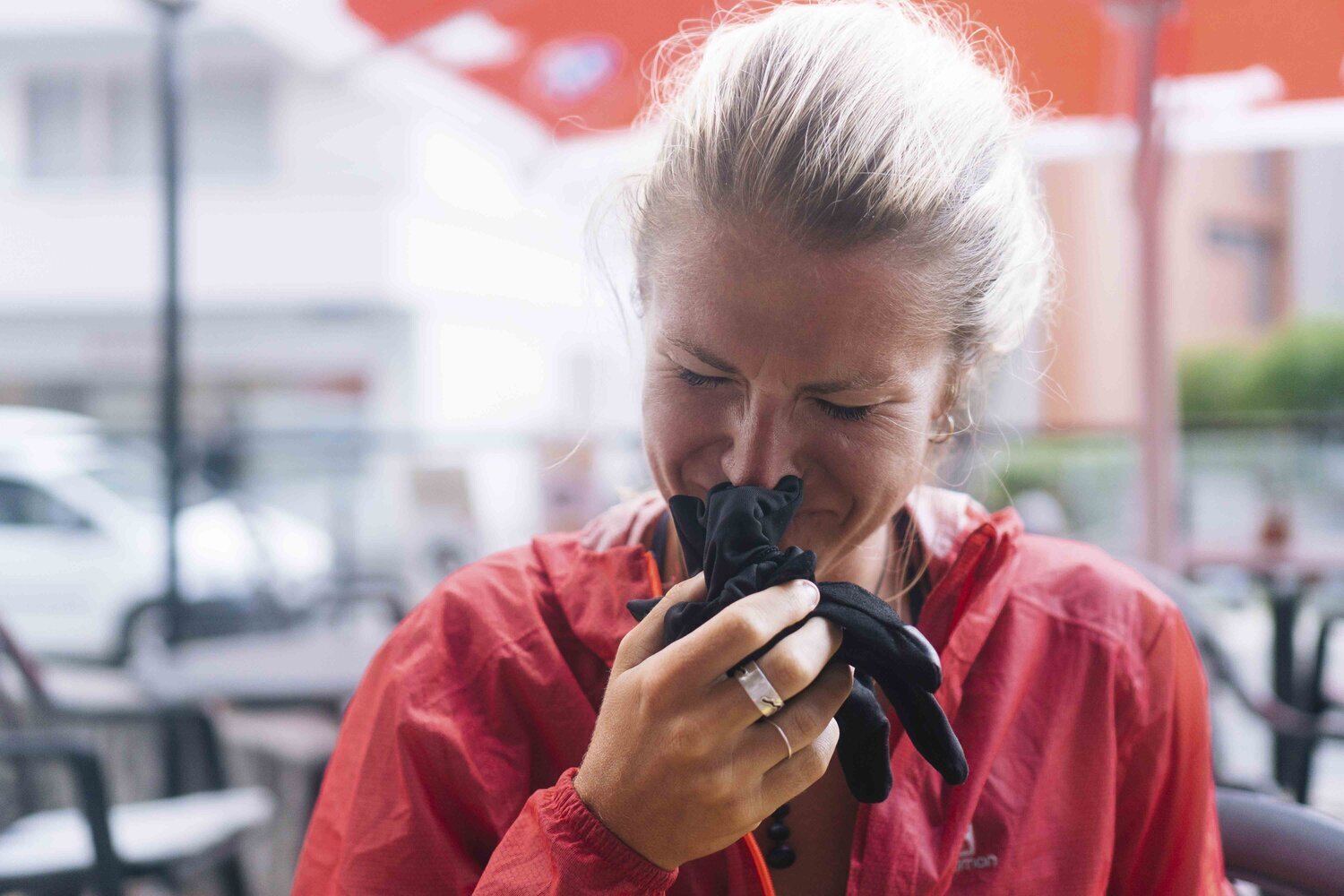
Alex always smelling her dirty socks to check on them…


We were feeling good this day, but had to cut the day short due to bad weather. We got treated to a free night at Trubsee Lake by Engelberg Tourism, had a five-course meal with seconds of each so more like a 10 course meal, jumped on a trampoline under Mt. Titlis and got as much sleep as possible, knowing the following day would be one in which we had to catch up on lost kilometers.
DAY 4
Distance: 70km
Vertical Climb: 4045m
Start - Finish Time: 05:15 - 23:00
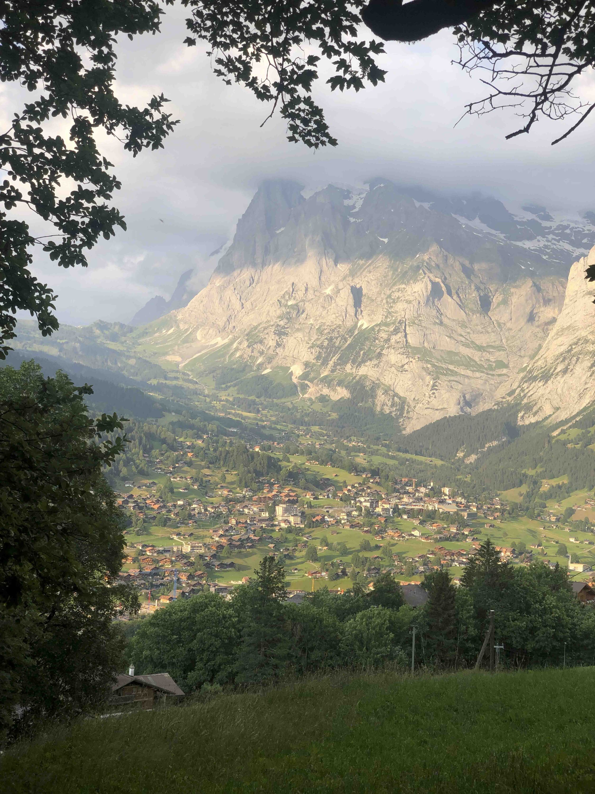
Trubsee (above Engelberg) > Jochpass > Meiringen > Grindelwald > Mannlinchen
To make up for lost time, we took off early with the hopes of going as far as we possibly could before midnight. We watched the sunrise over Engelberg behind us as we climbed up and over the Jochpass to descend incredible ridges and past Alpine lakes. I had a tough time this morning as we ran down pristine mountain bike flow trails on tired legs. It was one of those moments where it’s tempting to bail on the entire adventure, pick up a mountain bike, and enjoy the mountains in a different way. Enough dreaming… we moved onward toward Meiringen and faced one of the most brutal, never-ending 2000m descents, and planned to fuel up in Meiringen.


We arrived in Meiringen and loaded up on kebabs, thinking we were just a few hours away from our finish line. We climbed the Grosse Sheidegg to realize it was a lot longer than expected. This time it was a road bike I wanted to be on because the paved pass was one of the most scenic in the Alps. Matt and I reached the top of the pass quite beat-up, so Alex decided to take one for the team and run down to Grindelwald to prep dinner for the three of us before our last 1000m climb up to the night’s goal of reaching Mannlichen. She prepped an epic dinner, but the speedy descending run had broken her down while Matt and I recharged. The last climb up to Mannlichen was a tough, but beautiful end to the day. Hiking below the north face of the Eiger was, for sure, one of the overall highlights for us. Lining up our paces became difficult as we each started having different pains and mental fatigue, but we got to the hut in time for a beer and to watch the last light disappear over Wengen and the Lauterbrunnen Valley.


DAY 5
Distance: 51.1km
Vertical Climb: 3640m
Start - Finish Time: 06:30 - 22:30
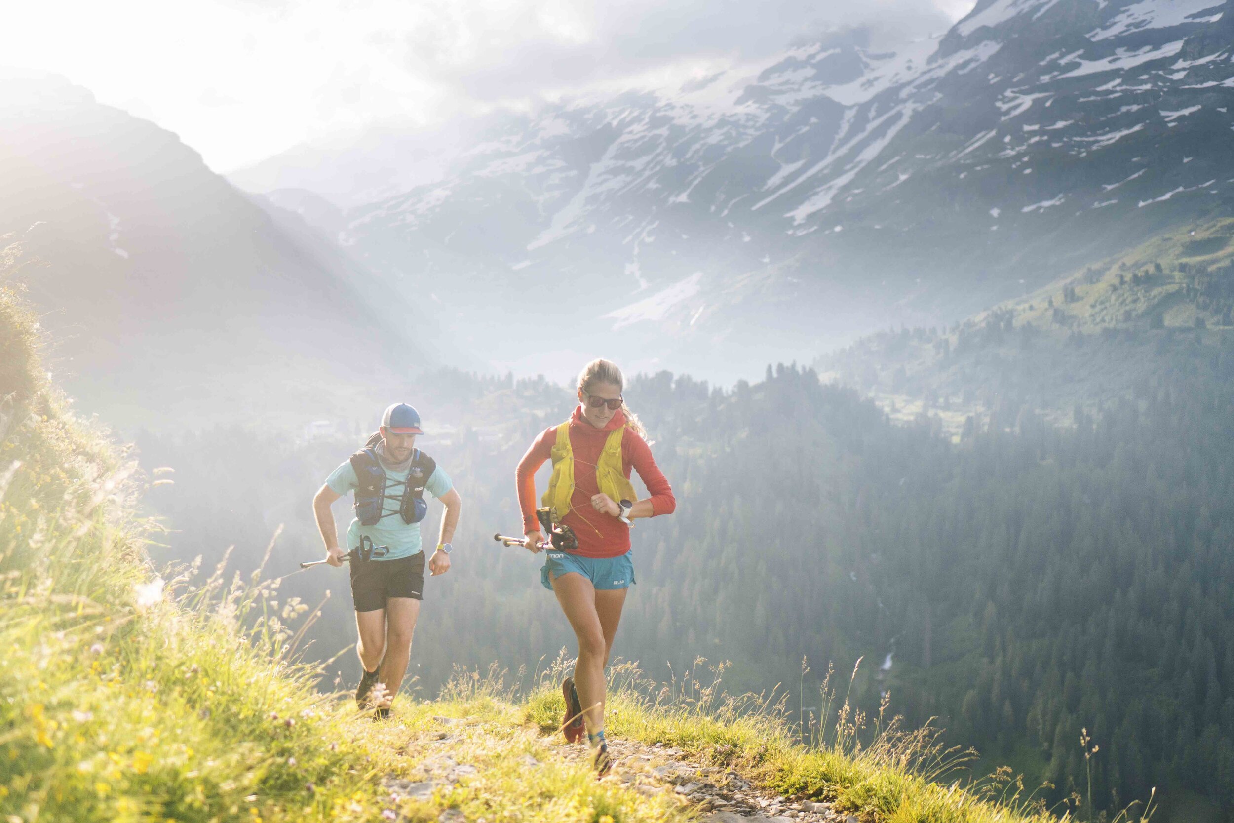
Mannlichen > Wengen > Lauterbrunne > Murren > Sefinafurgge Pass > Hohturli > Kandersteg
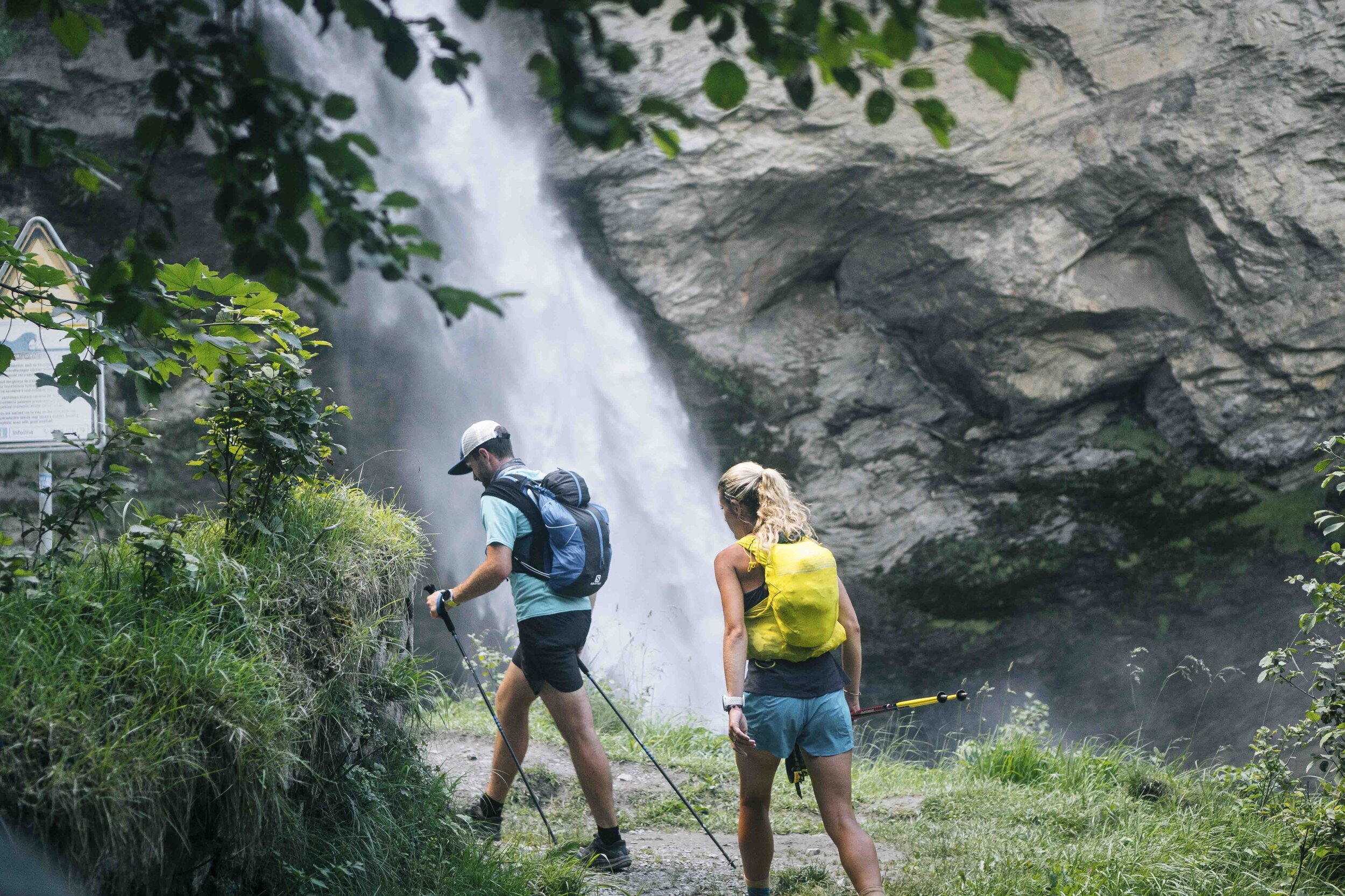
We got a good night’s sleep here, but woke up starving and ran down as fast as possible to Wengen for a solid bakery breakfast. After ice cream and pastries, we made our way to Lauterbrunnen to then start another rough, but spectacular climb.

The view from Mannlichen, looking down on Wengen, then Lauterbrunnen below and the town of Murren in the distance above the cliffs.
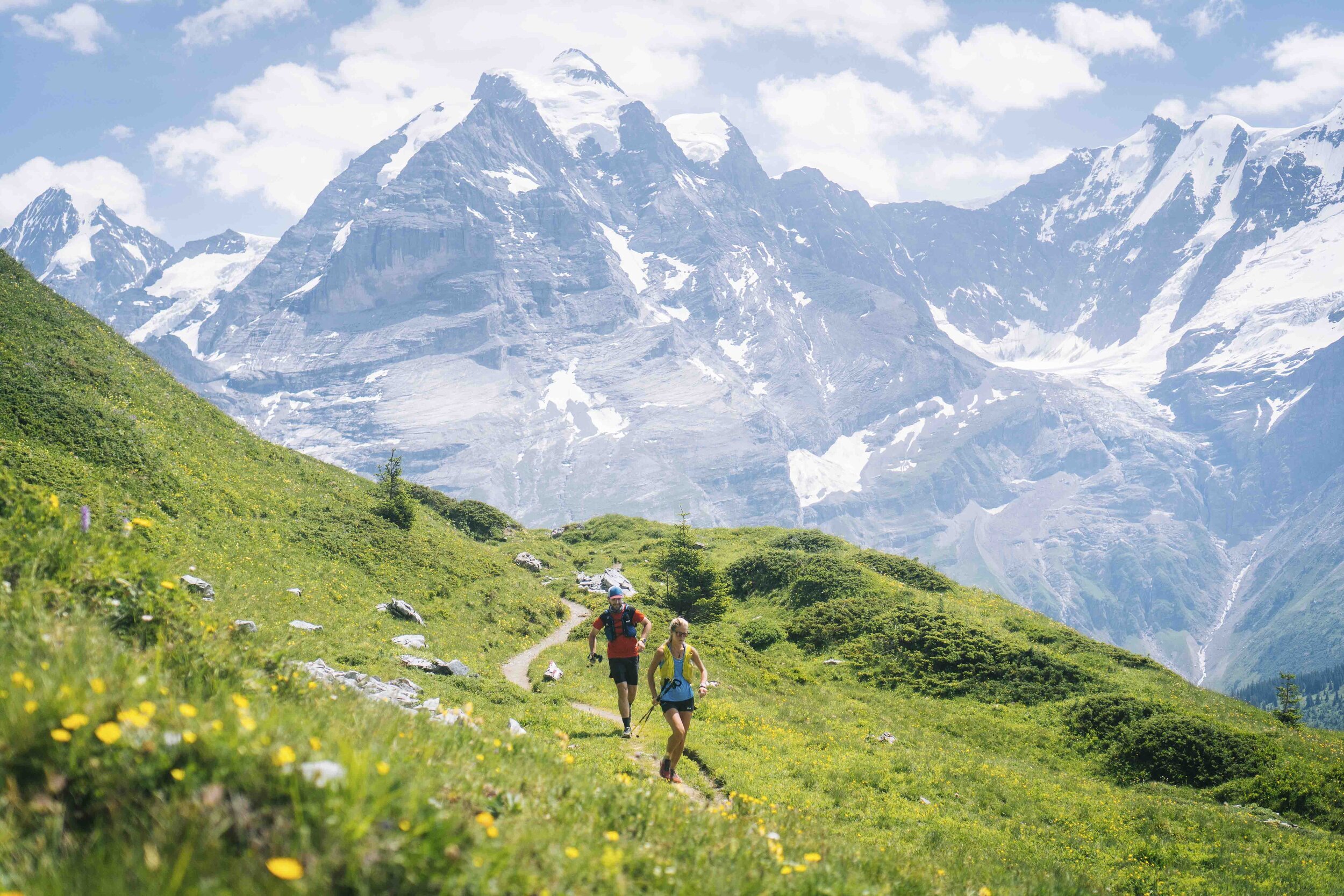
Our mood definitely picked up when we climbed above those cliffs in the distance. The views looking back toward the Eiger and the Jungfrau are some of my favorite memories of this run.
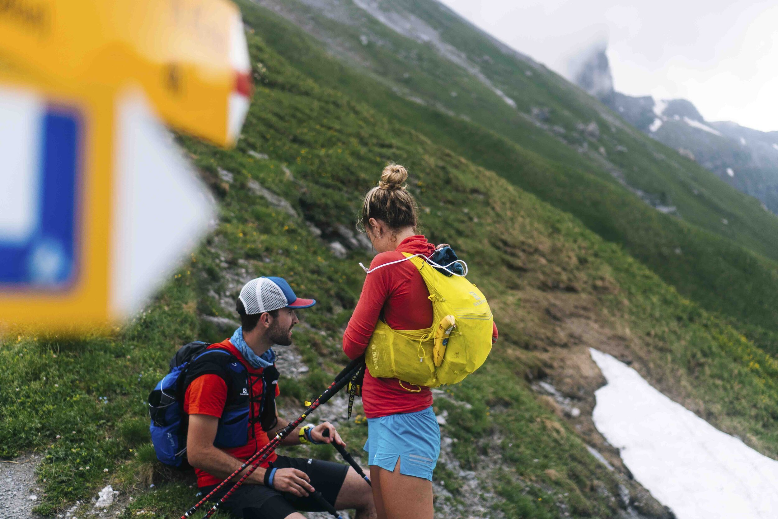
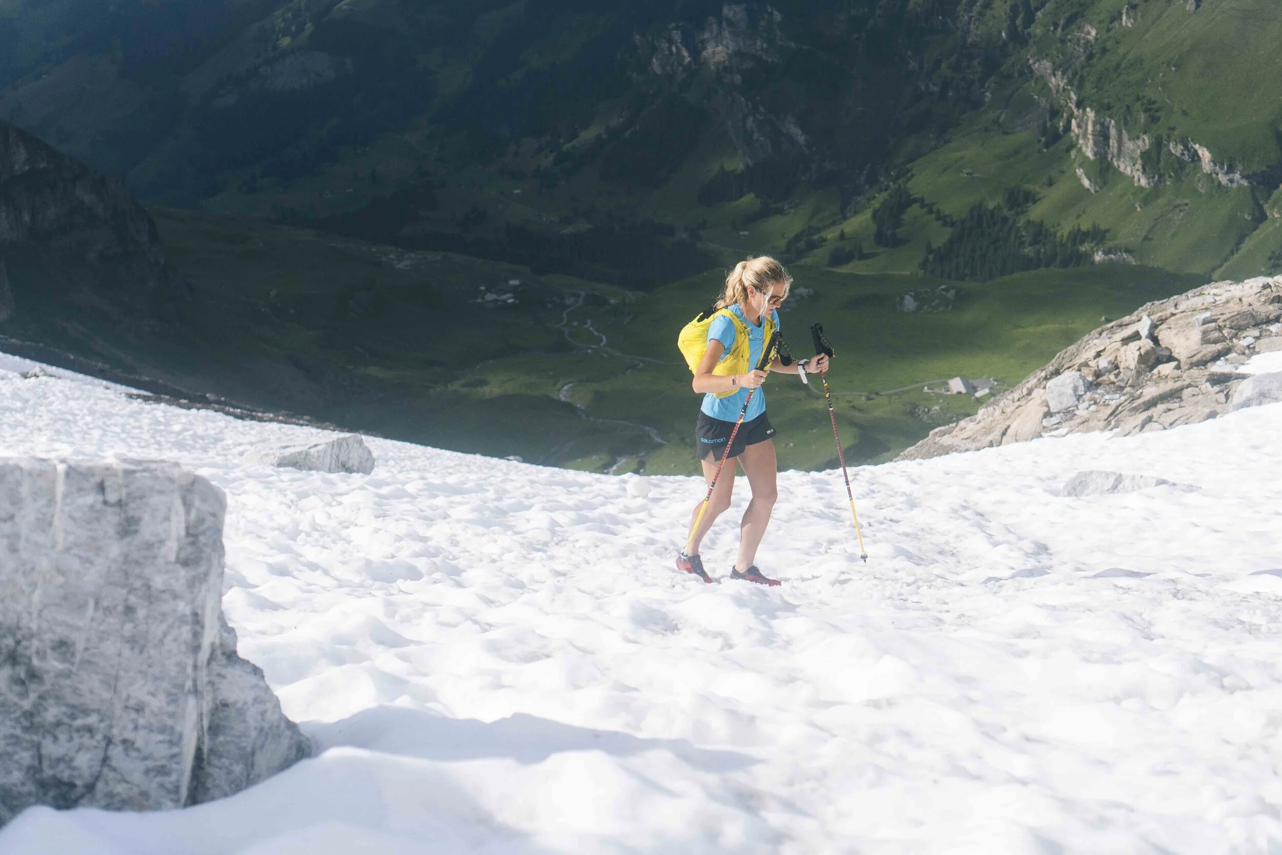
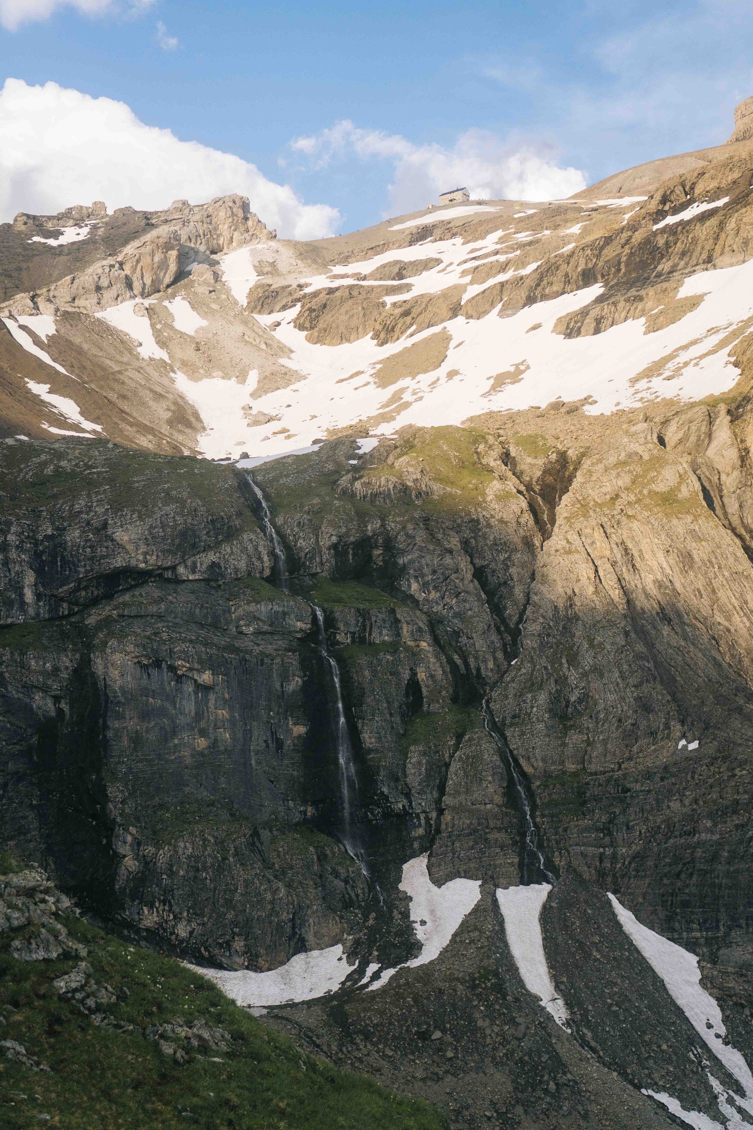
The climb quickly got steeper and the terrain turned to snow as we noticed some clouds moving in on us in the distance. The snow was slushy enough that we didn’t need to use our micro spikes and we picked up the pace, not wanting to be on top of a pass in a summer thunderstorm. Somewhere along this climb Alex had an allergic reaction to something. The only antihistamine we had was drowsy, but we thought, “who cares, we’re trail running, she’ll just power through it” so she took it...


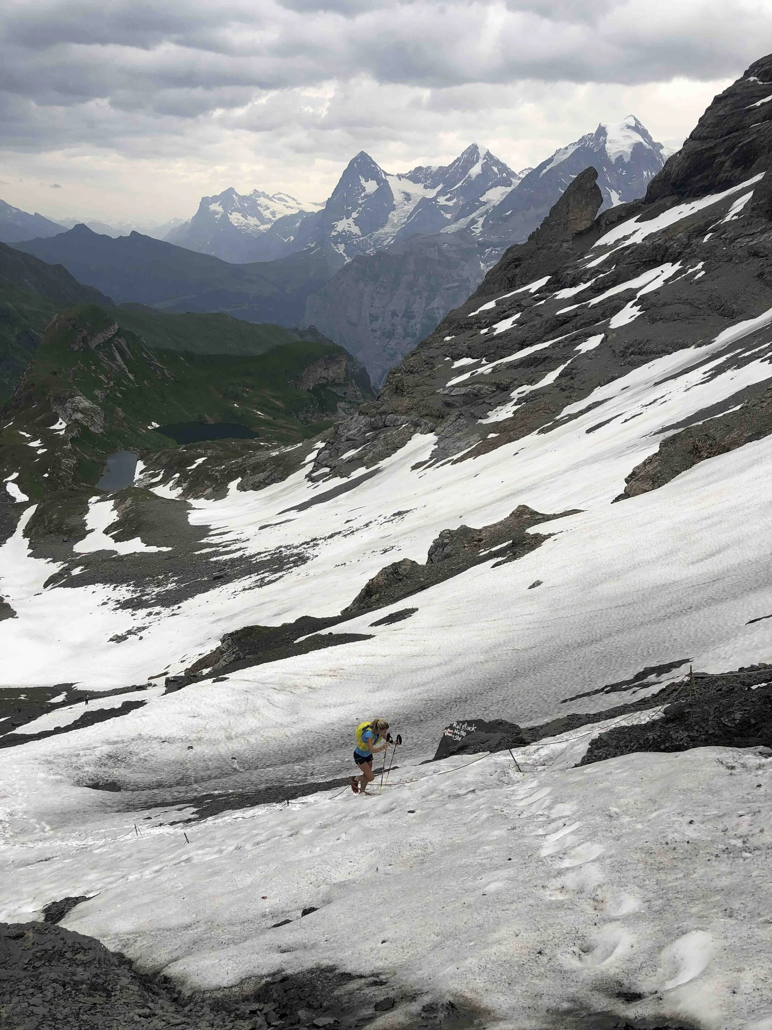

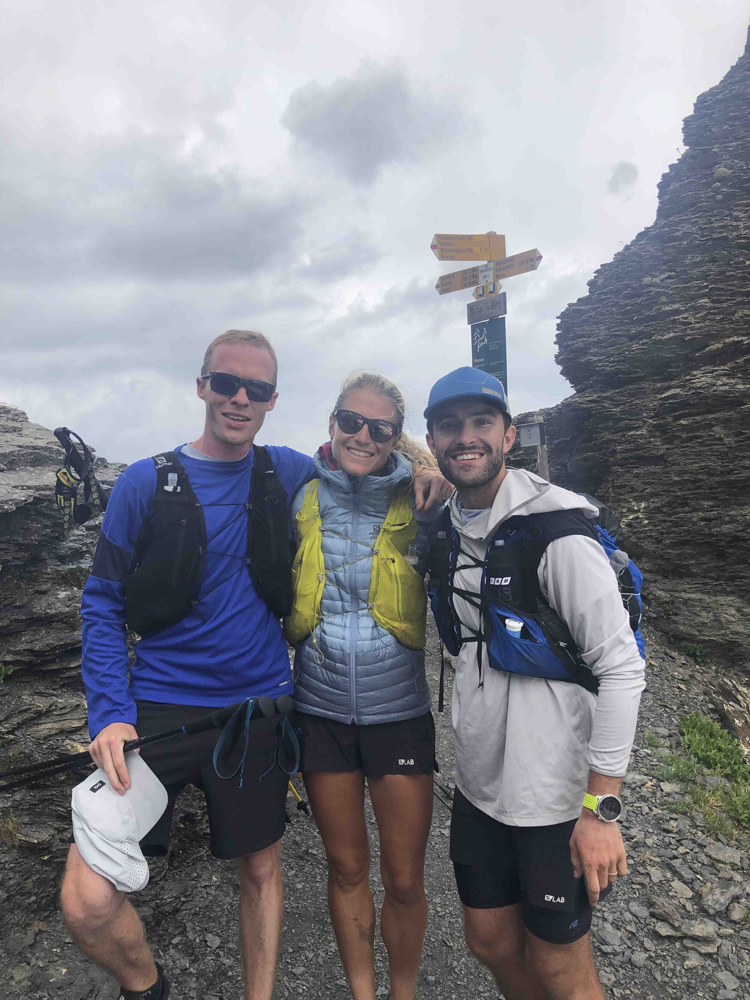

A few minutes after taking this team photo above, we heard a loud lighting strike and then saw weather move in more quickly than we’d ever seen in the Alps. We carefully made our way down the steep steps and those clouds in the distance moved in alarmingly fast. This might look like a timelapse below, but it’s not. It shows how quickly the clouds were actually moving. Within five minutes we were in the middle of the storm and, with no cover to be taken, we raced down the mountain.


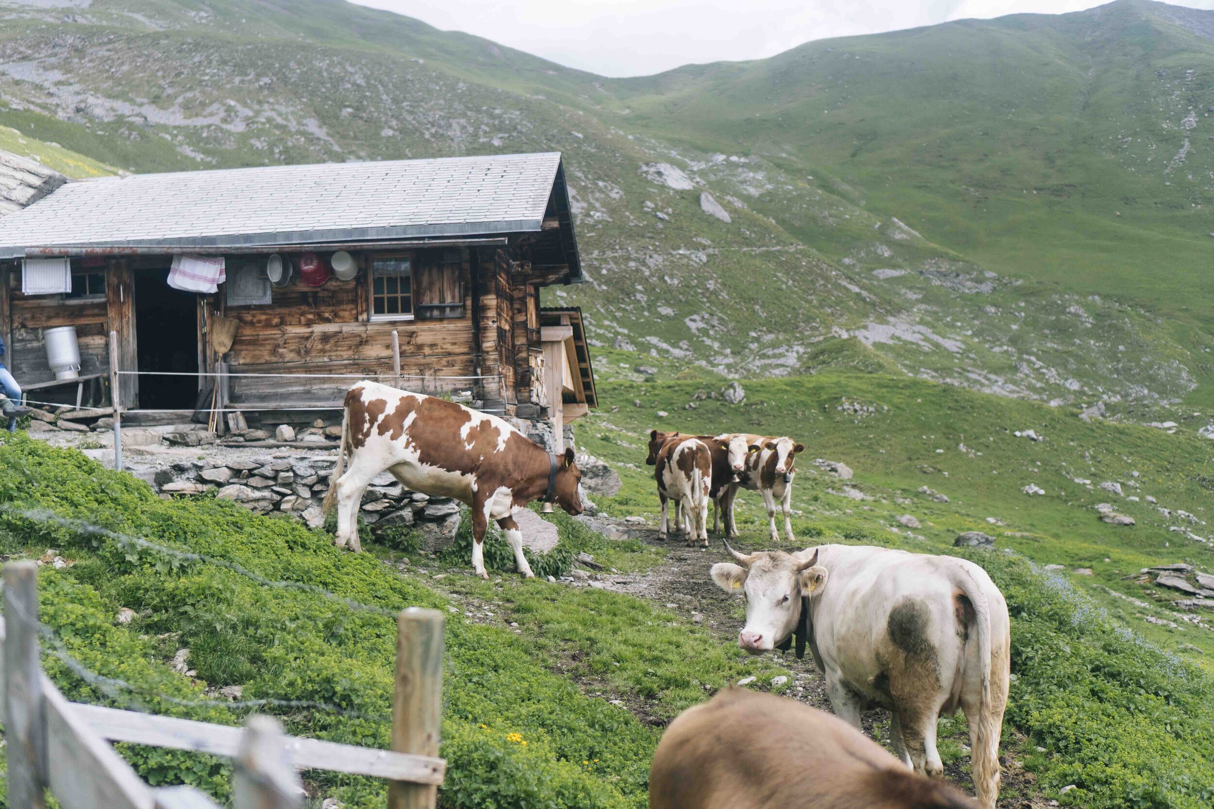
Halfway down the mountain we took cover for a moment in a barn with some cows. As soon as the adrenaline of being chased by the storm faded, Alex started not looking so good. Remember those drowsy pills she took earlier for her allergic reaction… yeah… they started putting her to sleep. She actually fell asleep with her forehead balanced on her poles. Matt and I stressed about time, knowing how much further we needed to go that day, and tried nudging her, but got no reaction. Thirty minutes later the sun began to come back out and I have no idea how Alex found the energy, but she started stumbling forward in the right direction toward our next mountain.


Moving on from this low was tough. We loaded up on all the sugar we had and continued stumbling forward. This afternoon was definitely the closest we got to bailing on this trip. We thought we could either go check-in to a nice hotel a few kilometers down the road, or climb another 1500m and down an additional 2000m to Kandersteg. Because we’re weird, we chose the latter.
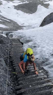
The climb up to Blüemlisalphütte was probably one of the most dangerous, but with a good weather window, we went for it. The steps were covered in ice and we were approaching sunset.


We somehow reached Blüemlisalphütte, took off our sweaty shoes and vests and walked into a room of a hundred alpinists and hikers, who were clean and seated comfortably, eating dinner. We definitely felt out of place while everyone continued staring at us. The hut offered us some hot soup for dinner and at 20:00 we took off for the remainder of our day, the long descent to Kandersteg.


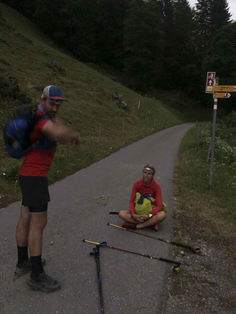
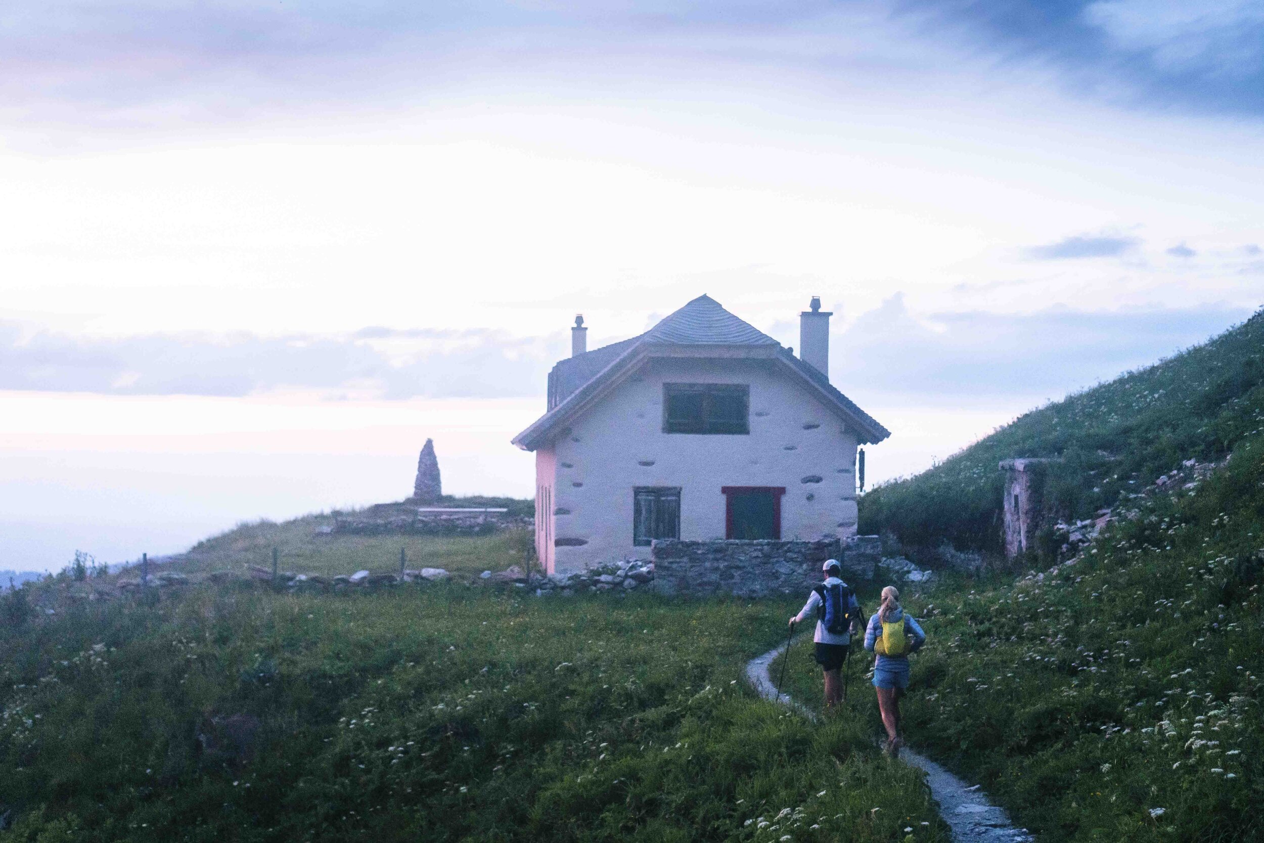
22:00 naps on pavement started to become a tradition. Delirious joking around, and hungry, sleepy, sore moments lying on that warm pavement are just the best. Just 5k from our finish line for the day, it was so hard to get back up again and finish. We checked into an AirBnB in Kandersteg and got ready for our second-to-last day.
DAY 6
Distance: 34km
Vertical Climb: 2000m
Start - Finish Time: 09:00 - 18:00
Kandersteg > Adelboden > Lenk
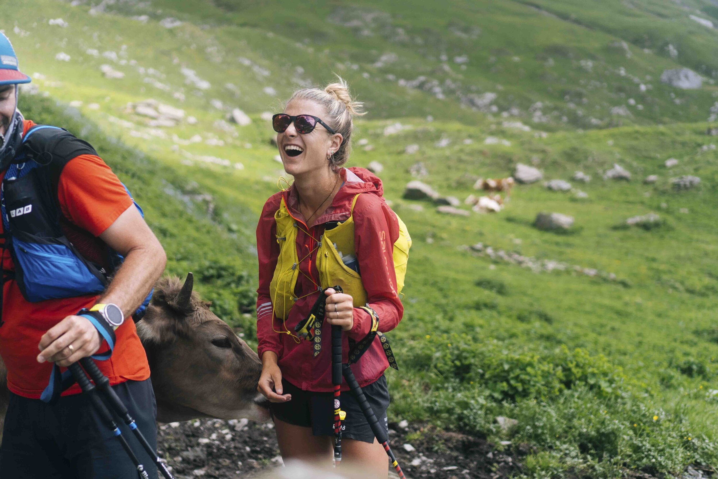
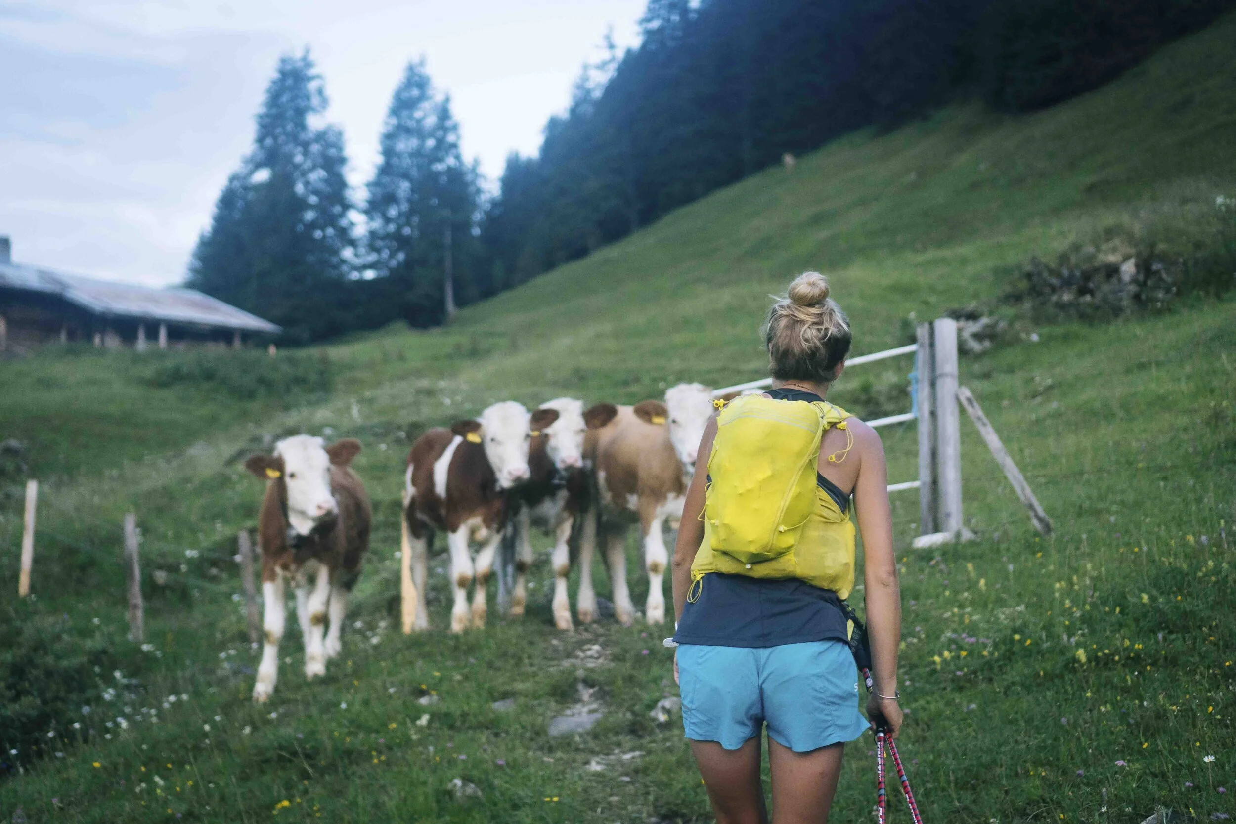
We took it easy on Day Six. Pretty beat up from the previous few days, we agreed we’d sleep in a bit, then try to get to Lenk by 18:00 so we could do laundry, catch up on lost calories, and prep for our final big push to Montreaux the day after. An easy day like that reminded us that trail running can actually be fun if you don’t set absurd goals for each day. We did some running, making friends with local cows, taking time to ice our knees in Alpine fountains, actually cleaning our clothes at our destination, and eating a real, non-power-bar dinner before bed, where we thought about how we’d soon be repeating the whole process. There were lots of smiles on this day, trying not to think about the following one.


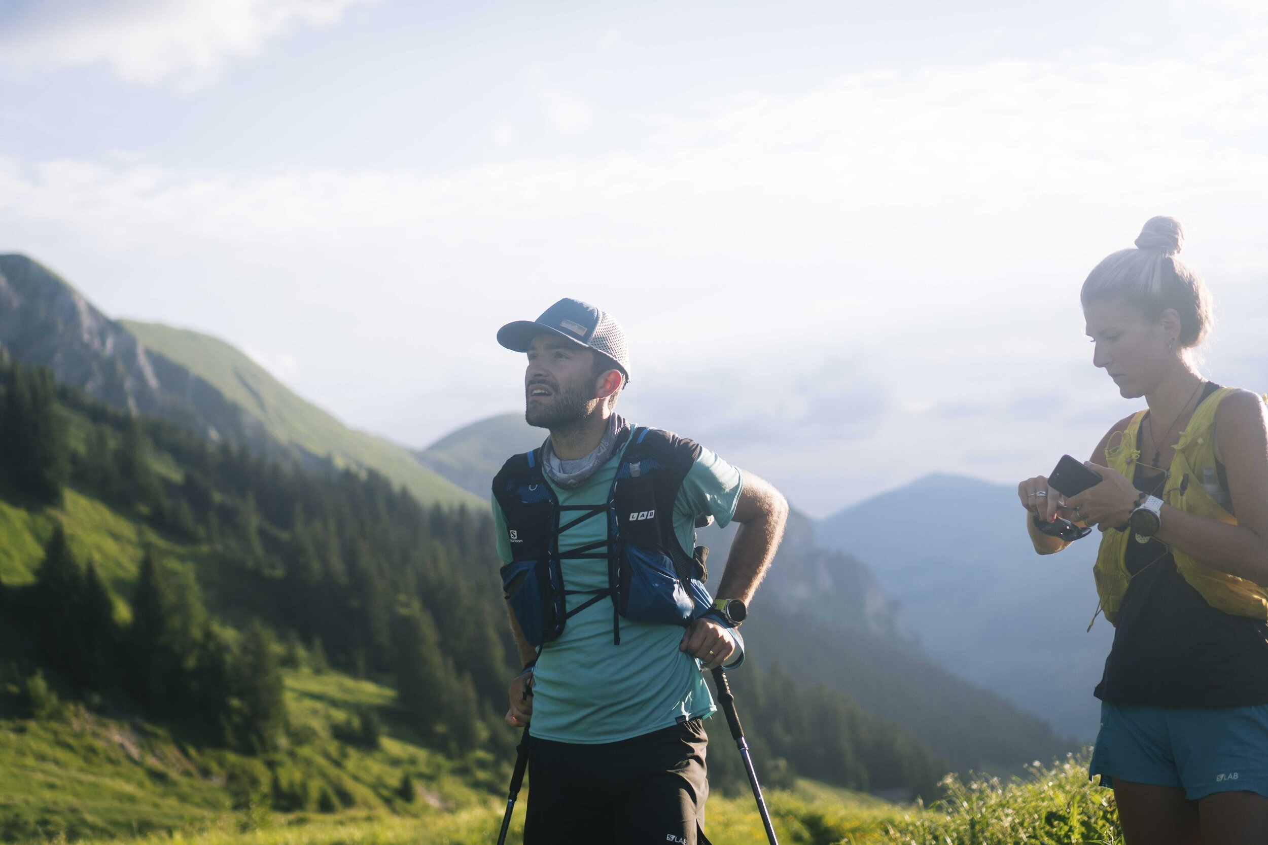
Given the option to nap at a bakery in Adelboden or shop for the following day’s breakfast, Milo chose a nap. That soon backfired as, while we fell asleep, Milo realized he only had a Mars bar and a pack of Nutella for breakfast the next morning and we wouldn’t have a food opportunity for 30km to Gstaad…
DAY 7
Distance: 80km
Vertical Climb: 3750m
Start - Finish Time: 05:30 - 23:30
Lenk > Gstaad > L’Etivaz > Rochers de Naye > Montreaux
We started early on this day and were feeling fresh. The anticipation of possibly reaching our finish line - hopefully before midnight - excited us. I struggled hard for the first 30km as I’d had basically no breakfast. We arrived in Gstaad and raided a Migros supermarket. We feasted on the side of the swanky streets of Gstaad, watching people walk out of their five-star hotels giving us strange looks. These pit stops in towns became a race of their own: eat and drink as many calories as possible before taking off again.

Leaving Gstaad behind, we soon crossed a simple stone wall that marked the border with the Swiss French part of Switzerland. We descended into L’Etivaz, consuming as much sugar as possible and telling locals we were heading to Montreaux. They laughed at us, assuming we were trying to make jokes in broken French.


Blister-checks, shoe-smell checks, and more pavement naps...
We did a little dance at our first Montreux hiking sign. We got our first glimpse of Lake Geneva, but the excitement was quickly shot down when we realized the trail didn’t go toward the lake, but took us up another 400m to the top of Rocher De Naye. We finished the last of our sugar and pushed for our final climb past some incredible sunset views over the mountains we had passed earlier that day.


We reached the top, finished any extra pain killers we had on us, and started the 2000m descent to our finish line. Not sure whose idea it was originally to try to finish before midnight, but that deadline turned into a full-on race against time. With jello legs, we stumbled our way down, treated by the most epic sunsets we had seen in awhile. We took turns pushing one another to move faster on the downhill. Halfway down the mountain we realized, once again, all restaurants and supermarkets would be closed by the time we arrived. We Google mapped a McDonald’s and, since it closed at midnight, that made our goal that much more real.


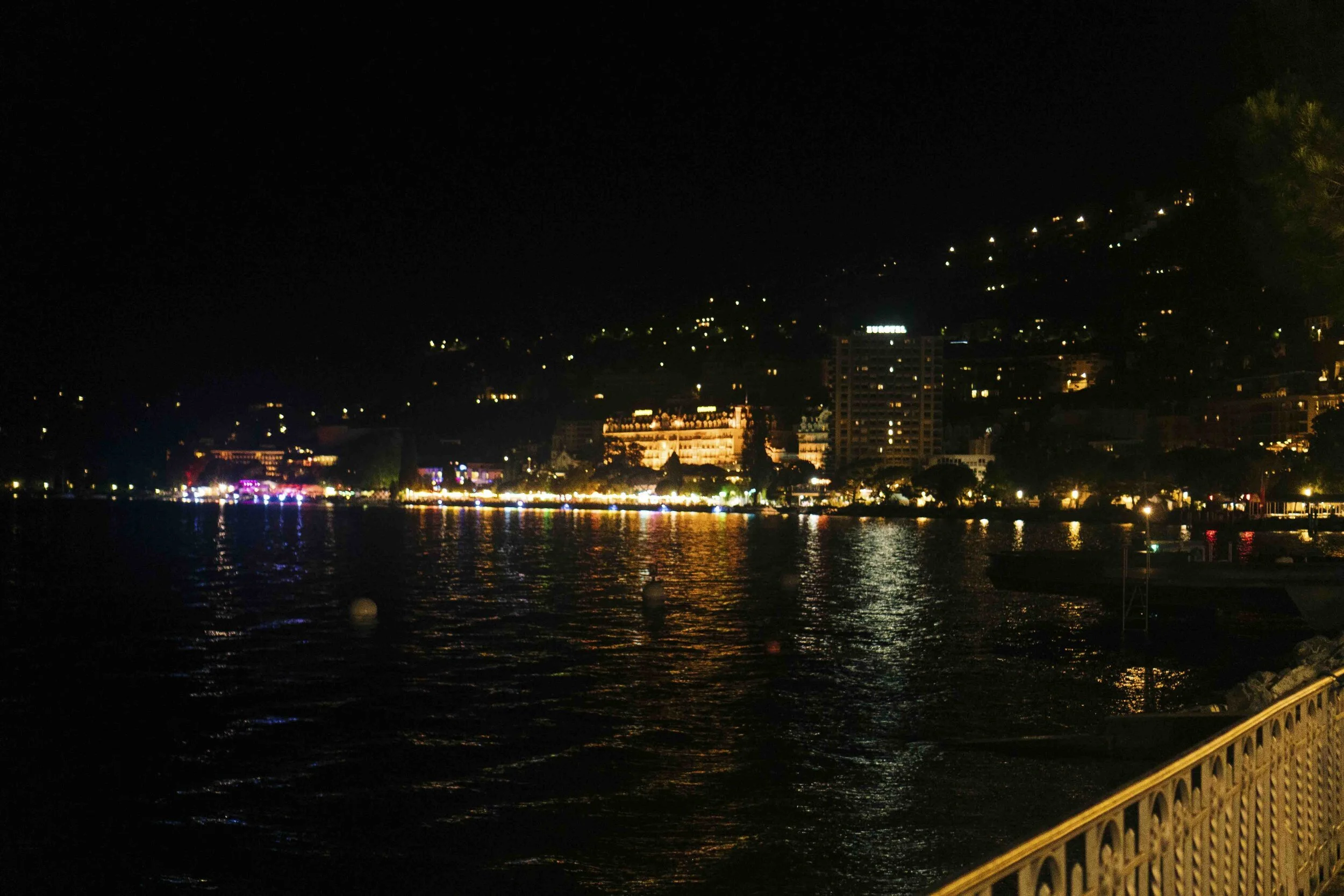
We arrived in Montreux at 23:40 after moving for six days, eighteen hours, and forty minutes. Total distance was 382km with 21,602m of vertical. We took a group picture on the lake, ate way too much McDonald’s, stumbled to a hotel, and finally passed out for as long as we wanted.


Thanks to Salomon for supporting this adventure and to all our friends and family who kept us going when it would have been easy to bail. We’re not sure what the next adventure will be, but I’m not sure I want to go any further.
For our portfolio images taken for Salomon from this run, click here.
If you have any questions, feel free to send Milo a message at milo@milozanecchia.com or comment below.